InterRisk Thai Flood Report
Summary
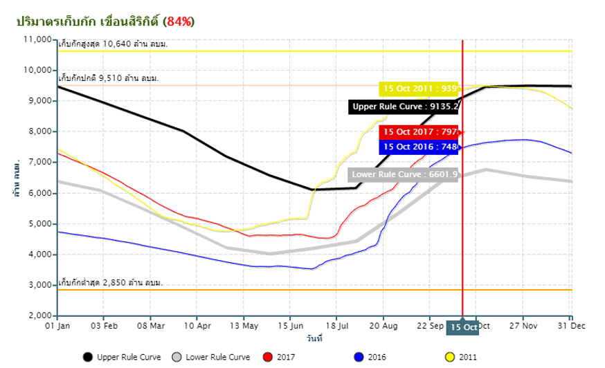
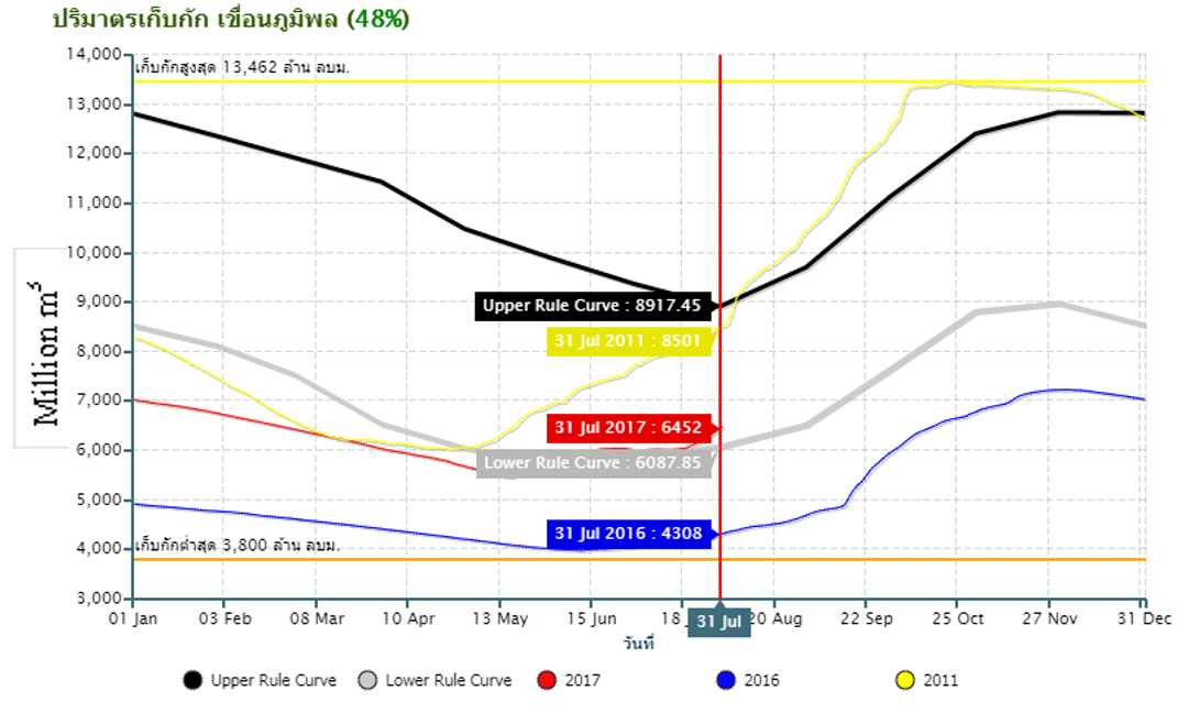
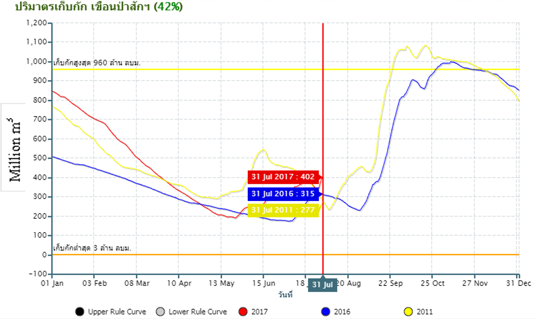
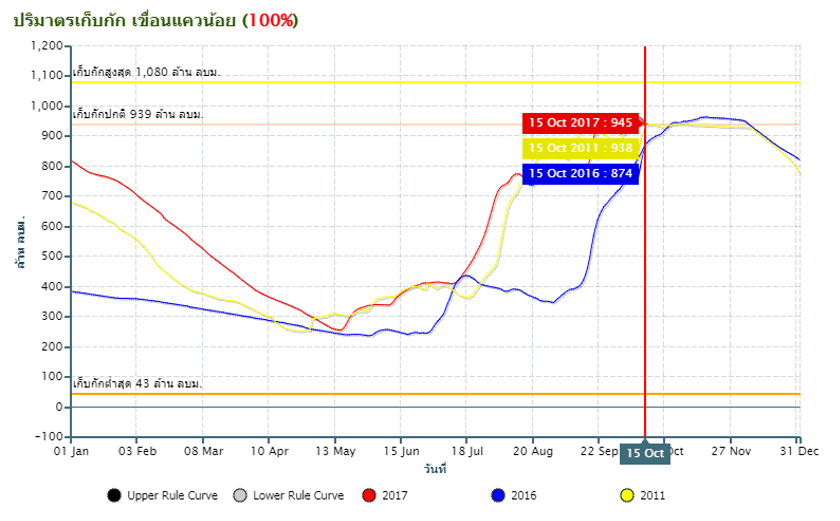
The water volume of main dams has been increasing due to the heavy rain in last week. Bhumibol and Sirikit dams can still receive more amount of water, while Pasak and Kwae Noi dams are almost at their full capacity.
The lower Chao Phraya provinces are critical, especially in Ayutthaya, Angthong, Chainat and Pathumthani where some riverside areas are flooded which resulted from the increased water released from the upper Chao Phraya river through the Chao Phraya river dam.
Rain will continue until next week all over the country which is influenced from coverage of low pressure air from China and monsoon.
Government announcements
Department of Disaster Prevention and Mitigation has coordinated with 34 riverside provinces in north, northeast and central regions to prepare for the incoming water situations. By monitoring, analyzing any risk from amount of rain water and water level. If the situation spreads out, there will be prepared rescue team with equipment and machines.
Flood events:
Flood incidents in the past week:
11th Oct: All night rain in Pa Yao caused flash flood in Mae Sai Sub-District with water level up to 50-70cm.
12th Oct: Chao Phraya river near Ang Thong Province overflowed the dike to damage the Pa Mok District.
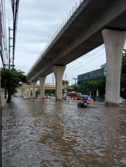
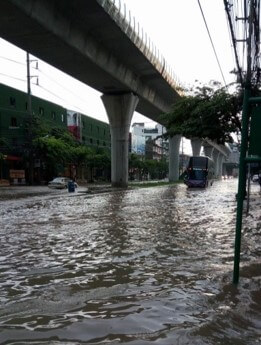
14th Oct: Heavy rain during the night of 13th caused flood in many roads of Bangkok, including Wipawadee,
Ratchadapisek, Petchburi, Ladprao and Petkasem.
14th Oct: Nine Chao Phraya riverside Districts of Ayutthaya were flooded. Moreover, there were 26 Districts in
8 Provinces (Lopburi, Kumpangpetch, Singburi, Angthong, Ayutthaya, Nakhon Sawan, Chainat and
Tak) that were being affected by flood.
Situation: Ayutthaya Flood
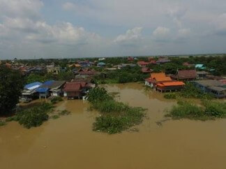
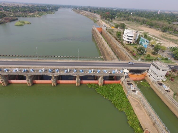
Currently there is a flood in some area in Ayutthaya Province. In Bangnan and Sena district. However, these areas are frequently flood as report in last year report. The maximum depth is 1.5m. The amount is higher than last year 2,100 sq.m/s. According to the news the water level in the area can be cleared within 1 week. The amount of water release from Choaphraya dam is now over 2,500 sq.m/s since 10th October.
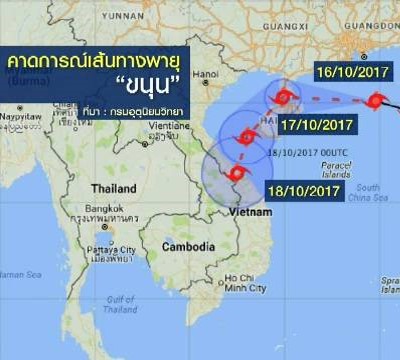
Situation: Hurricane warning
From 16th October typhoon “Khanun” has decreased its intensity and become depression. The depression is now moving toward “Hainan, China” and moving downward to Vietnam. According to the RID, it may not directly affect Thailand but may contribute to the rainfall in Thailand.
Situation: Bangkok Flood
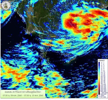
Last 13th Oct high amount of rainfall occured in Bangkok, according to TMD the amount of rainfall is approximately 200mm within 6 hours. Resulted in inland flood due to the in ability to drain the water. The concentrate amount of rainfall is shown in the diagram below. The high amount of rainfall focus in the central Bangkok area. The flood depth is approximately 30-60 cm where the most depth is at Wiphawadi road.
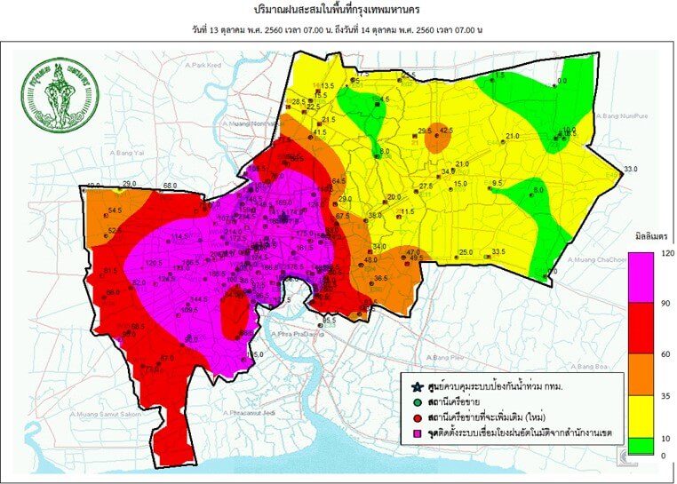
Flooded roads
Storage level Sirikit Dam
Storage level Bhumibol Dam
Storage level Pasak
Storage level Kwaenoi Dam
The Upper Chao Phraya River Flow
The amount of water from Upper Chaophraya has increased. The critical area is in Phichit area where Yom and Nan river adjoins. The amount of water increased largely came from Ping and Wang river. The amount of water at Chao Phraya river dam has increased and is near its capacity. Amount of water released is also increased.
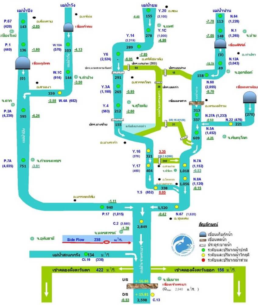
The Lower Chao Phraya River Flow

References
https://www.thairath.co.th/content/1013932
https://www.tmd.go.th/7-day_forecast.php
http://water.rid.go.th/flood/plan_new/chaophaya/Chao_low.php?cal2=15082017