Introduction
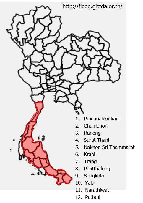
Since the end of 2016, many Thailand’s southern provinces had to face severe flooding disaster which were the result of the continuous rainfall in the region. So far, there were 12 affected provinces which are Prachuabkirikan, Chumphon, Ranong, Surat Thani, Nakhon Si Thammarat, Krabi, Trang, Phatthalung, Songkhla, Yala, Pattani, Narathiwat. Several economic areas were damaged by flood such as Koh Samui in Surat Thani province, many roads and railways were also affected by the flood causing the transportation to the south to be paralyzed. The government and individuals were sending aid into the areas. Now, flood situations in five provinces (Yala, Ranong, Narathiwat, Pattani and Krabi) are now relieved. However, people in the inundated provinces are still need to be careful and prepare for the incoming rainfall next week.
Causes
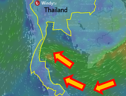
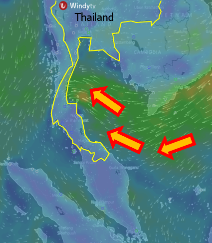
This 2016/2017 southern Thailand’s flood was resulted from the continuous heavy rainfall in the southern Thailand which was caused by the northeast monsoon that brings humidity from the sea to land. This huge amount of rain water caused the drainage to be unable to release the water to the sea. However, there will be more rain in the southern Thailand, in some provinces, there will be heavy rain, said the officials.
Damages
Twelve provinces were damaged by flood water, there were landslides and flash floods in many areas. So far, 43 people were reported dead, 20 official places, 5,498 villages in 119 Districts, 1,135 roads were damaged. The economic areas were also affected by the flood such as Koh Samui, Khanom and Pak Panang in Surat Thani province. Flood water has also damaged the agricultural areas causing the scarcity of food for cattle. Rescues has been sending into the areas. The navy have supported the boats to push flood water into the sea.
Flood events
6th Jan 2017: Nakhon Sri Thammarat airport was closed for 2 days due to the paralyzed.
6th Jan 2017: Surat Thani train station became the terminal station for southern railroad.
6th Jan 2017: Flooding in Phatthalung caused 3 deaths. 11 Districts were affected by flood. There was also landslide in some areas.
8th Jan 2017: Continuous rainfall caused 20 cm-high flood in downtown of Krabi.
12th Jan 2017: High flood water in many areas caused the trains heading to Trang to stop the service.
14th Jan 2017: Seven southern provinces are still flooded. While, floods were gone in 5 provinces which are Yala, Ranong, Narathiwat, Pattani and Krabi.
Forecast
The northeast monsoon across the Gulf intensifies with more rain expected with heavy in some parts of the South. Waves are forecast up to 2-3 meters high in the Gulf.
Meteorological Department of Thailand reported that there will be heavy rainfall in southern provinces on 16-20 January. People in the areas still need to be cautious of the possible flash flood and landslide.
The Upper Chao Phraya River Flow: http://water.rid.go.th/flood/plan_new/planup.html
The water levels in all rivers and dams are at normal level . The water level in Chao Phraya Dam is at normal level.
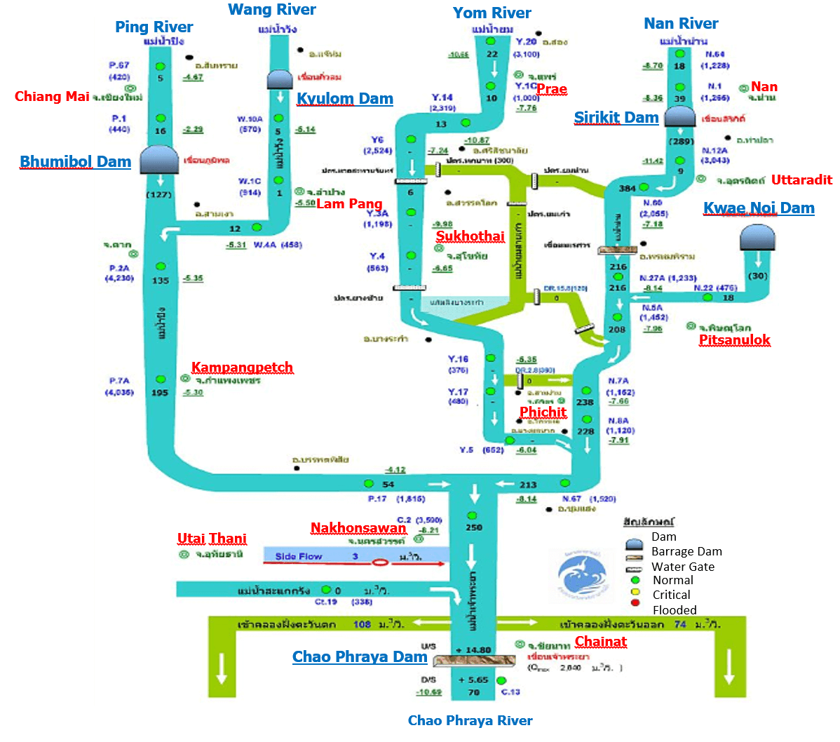
Note: – Numbers in black indicate the flow rate of water in m3/sec.
– Numbers in bracket indicate the storage level of water in m3/sec.
– Numbers with underline indicate higher (+) or lower (-) of water level than the river bank in meters.
– Water levels upstream (U/S) and downstream (D/S) of the dam in meters compare to mean sea level.
The Lower Chao Phraya River Flow: http://water.rid.go.th/flood/plan_new/chaophaya/Chao_low.php?cal2=12012017
Overall, the water flow rate at the Chao Phraya River is normal. The incoming water is at normal capacity. Currently the irrigation system is still able to manage the amount of incoming water.
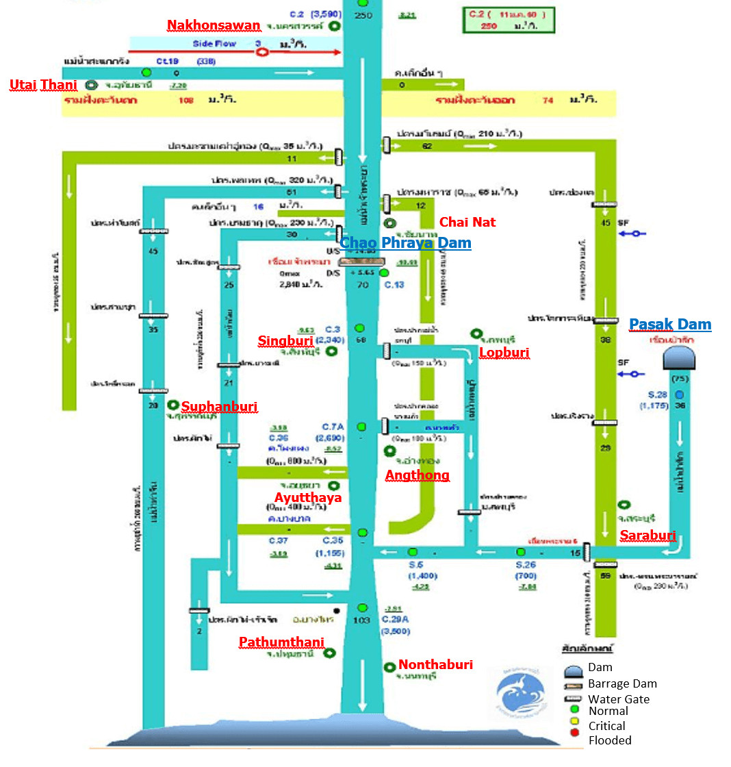
Note: – Numbers in black indicate the flow rate of water in m3/sec.
– Numbers in brackets indicate the flow rate of water in million m3/day.
– Numbers with underline indicate higher (+) or lower (-) of water level than the river bank in meters.
– Water levels upstream (U/S) and downstream (D/S) of the dam in meters compare to mean sea level.
References
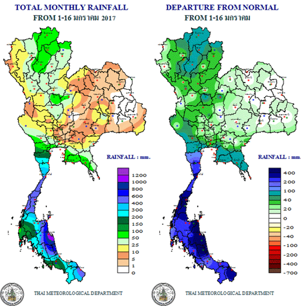
http://www.arcims.tmd.go.th/dailydata/MonthRain.php
http://www.tmd.go.th/thailand.php